Bestand:Bouvet Map.png
Naar navigatie springen
Naar zoeken springen

Grootte van deze voorvertoning: 787 × 600 pixels. Andere resoluties: 315 × 240 pixels | 630 × 480 pixels | 1.008 × 768 pixels | 1.280 × 975 pixels | 2.804 × 2.136 pixels.
Afbeelding in hogere resolutie (2.804 × 2.136 pixels, bestandsgrootte: 876 kB, MIME-type: image/png)
| Beschrijving |
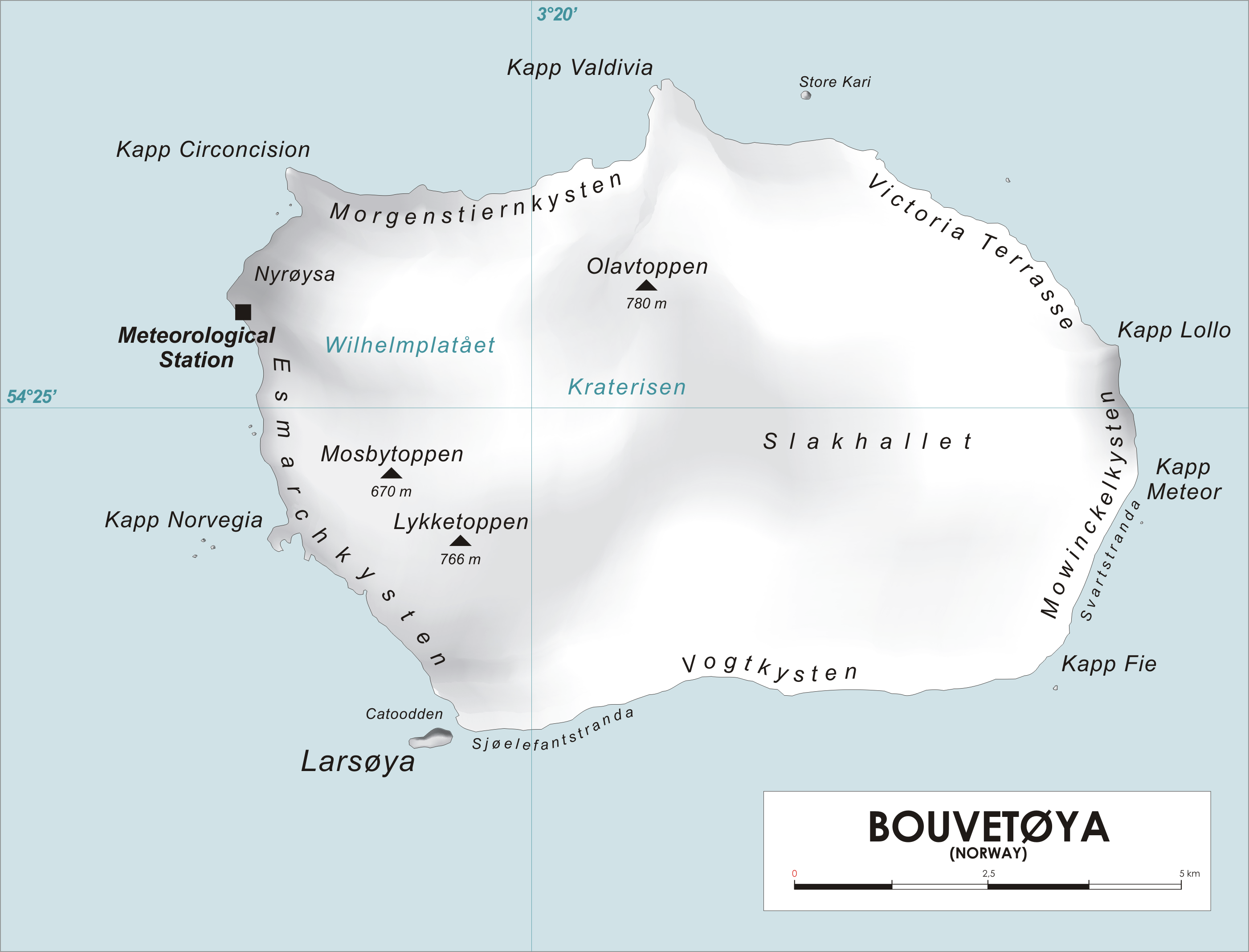
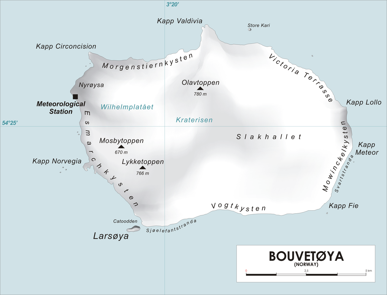
English: Map of Bouvet Island, Southern Atlantic Ocean Norsk bokmål: Kart over Bouvetøya, Sør-Atlanten |
| Bron | Eigen werk |
| Auteur | varp |
| Ik, de auteursrechthebbende van dit werk, geef dit werk vrij in het publieke domein. Dit is wereldwijd van toepassing. In sommige landen is dit wettelijk niet mogelijk; in die gevallen geldt: Ik sta iedereen toe dit werk voor eender welk doel te gebruiken, zonder enige voorwaarden, tenzij zulke voorwaarden door de wet worden voorgeschreven. |
Bestandsgeschiedenis
Klik op een datum/tijd om het bestand te zien zoals het destijds was.
| Datum/tijd | Miniatuur | Afmetingen | Gebruiker | Opmerking | |
|---|---|---|---|---|---|
| huidige versie | 28 apr 2006 14:25 | | 2.804 × 2.136 (876 kB) | Varp~commonswiki | *Map of Bouvet Island, Southern Atlantic Ocean *drawn by varp |
Bestandsgebruik
Dit bestand wordt op de volgende pagina gebruikt: