Bestand:Crimea republic map.png
Naar navigatie springen
Naar zoeken springen

Grootte van deze voorvertoning: 800 × 531 pixels. Andere resoluties: 320 × 212 pixels | 640 × 425 pixels | 1.031 × 684 pixels.
Afbeelding in hogere resolutie (1.031 × 684 pixels, bestandsgrootte: 65 kB, MIME-type: image/png)
Beschrijving
| Beschrijving |
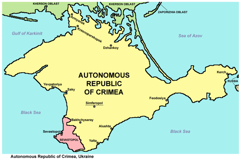
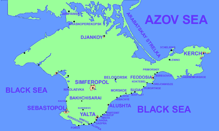
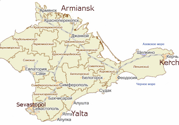
English: Map of the Autonomous Republic of Crimea and of Sevastopol, Ukraine.
Français : Carte de la République autonome de Crimée et de Sébastopol, Ukraine. Српски / srpski: Мапа Аутономне Републике Крим и Севастопоља, Украјина. |
| Datum | |
| Bron | Eigen werk |
| Auteur | PANONIAN |
| Andere versies |
         |
Licentie
Ik, de auteursrechthebbende van dit werk, maak het hierbij onder de volgende licentie beschikbaar:
| Dit bestand is beschikbaar onder Creative Commons CC0 1.0 Universele Public Domain Dedication. | |
| De persoon die een werk voorziet van deze licentie stelt dit werk beschikbaar aan het publieke domein door, voor zover dit wettelijk is toegestaan, afstand te doen van alle rechten op het werk in de zin van het auteursrecht, met inbegrip van alle aanverwante of naburige rechten. U kunt het werk kopiëren, aanpassen, distribueren en uitvoeren, ook voor commerciële doeleinden, zonder dat u daarvoor toestemming hoeft te vragen.
|
References
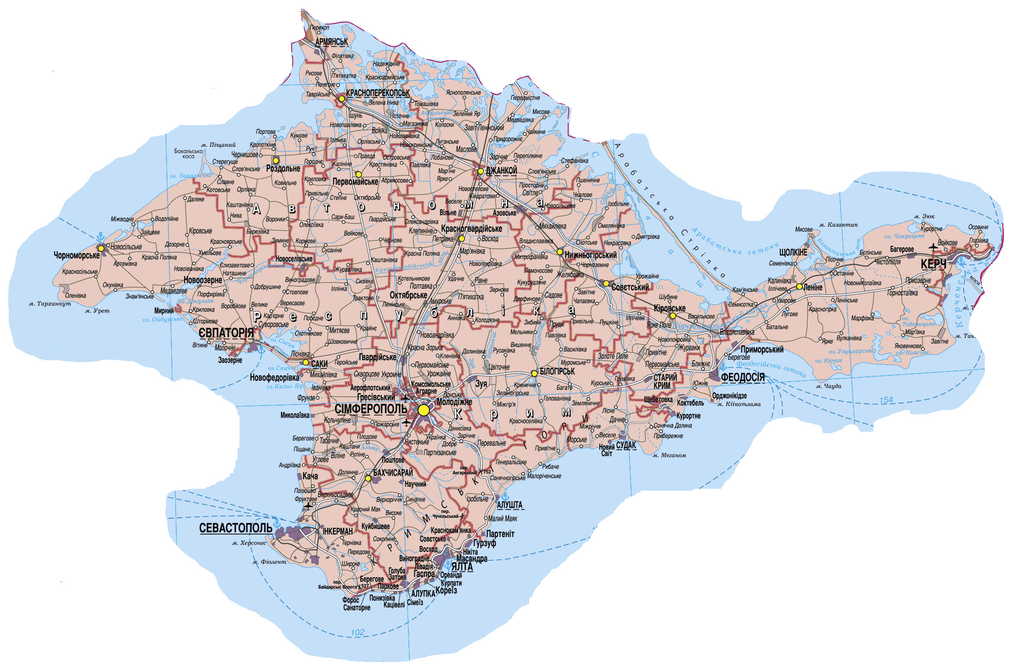
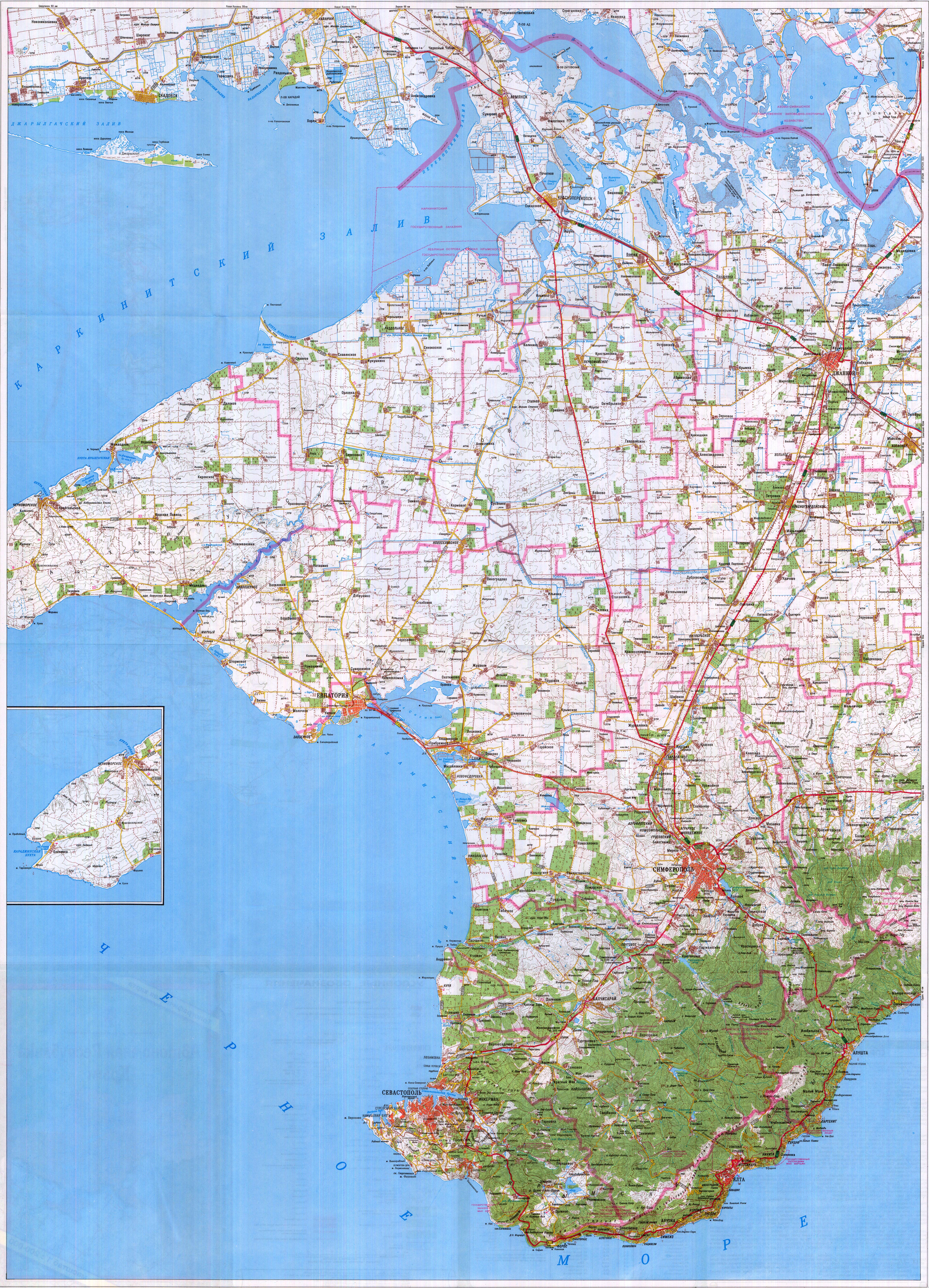
Maps from external links - entire Crimea:
- http://eurodialogue.org/files/fckeditor_files/crimea-map.gif
- http://www.lonelyplanet.com/maps/europe/ukraine/crimea/map_of_crimea.jpg
- http://www.rentmyflatinfeodosia.com/feodosia_guide/images/crimea_map2.jpg
- http://www.ukraine-travels.com/ukrainian-cities/images/crimea/crimea-map-s.jpg
- http://www.ua-business.com.ua/wp-content/uploads/2010/04/Canadian-investment-to-Crimea.jpg
- http://www.perekop.net/wp-content/uploads/crimea-map.gif
- http://mappery.com/maps/Crimea-Peninsula-Map.jpg
- http://www.globalsecurity.org/military/world/ukraine/images/crimea-map1.jpg
- http://www.riverofjoy-crimea.org/sitebuilder/images/Light_of_Crimea_TOPOGRAPHICAL_MAP_w_callouts-816x660.jpg
- http://www.mt.crimea.com/image/map_of_crimea.gif
- http://travel.kyiv.org/crimea/map/crimea_l.gif
- http://www.accesscrimea.com/images/map_crimeaprev.gif
- http://www.discover-ua.info/uploads/images/Crimea/map_of_crimea.gif
- http://www.nlminfo.org/userfiles/Image/map%20crimea0201.jpg archief kopie op de Wayback Machine
- http://www.crimeamap.com/crimea_images/colorcrimeamap600x450-2.jpg archief kopie op de Wayback Machine
- http://ruraltourism.com.ua/uploads/Image/oblast/eng/01.jpg
- http://www.oocities.org/new11world/crimea_map_en.jpg
- http://www.crimeahike.com/images/Crimea_Map_en.jpg archief kopie op de Wayback Machine
- http://1.bp.blogspot.com/_-IladB6V24I/SPlo3CapnxI/AAAAAAAAB_E/OyjdgvtBpgU/s400/03.MapCrimea.Added..jpg
- http://weecheng.com/europe/bbs/crimea/crimea-map.jpg
- http://www.travel2crimea.com/image/common/map_of_crimea.png archief kopie op de Wayback Machine
- http://www.mapofukraine.net/outdoor_activities/image/rockclimbing/crimea_climbing_map.gif
- http://novaonline.nvcc.edu/eli/evans/Photos/Russia/Yalta/Map.jpg
- http://www.ukrainebiz.com/maps/road_crimea.jpg
- http://coolhaus.de/misc/crimea-map.jpg
- http://russia-map.info/559885_BIG_0_0.jpg
- http://siriys-info.com/uploads/map/map1-crimea-full.jpg[dead link]
- http://siriys-info.com/uploads/map/map3-crimea-full.gif archief kopie op de Wayback Machine
- http://siriys-info.com/uploads/map/map2-crimea-full.gif[dead link]
- http://vhodv.com/map/images/map_krym_b.jpg archief kopie op de Wayback Machine
- http://our-travels.sumy.ua/ost/foto/Krym/135.jpg[dead link]
- http://www.raster-maps.com/images/maps/rastr/ukraine/atlas/crimea_karta.jpg
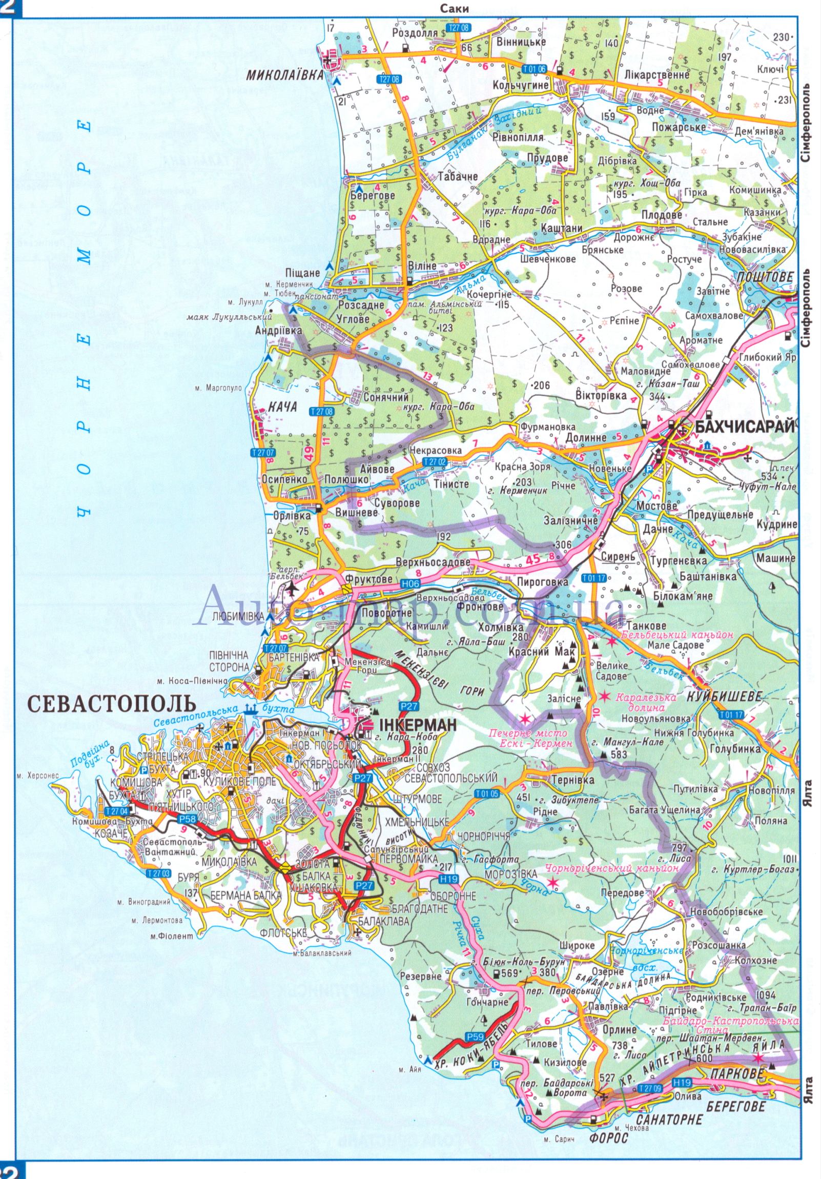
Maps from external links - Sevastopol municipality:
- http://siriys-info.com/uploads/map/map1-crimea-full.jpg[dead link]
- http://novaonline.nvcc.edu/eli/evans/Photos/Russia/Yalta/Map.jpg
- http://auto-map.com.ua/379819_BIG_0_0.jpg
- http://www.justmaps.org/maps/images/ukraine/sevastopol-map2.jpg
- http://vhodv.com/map/images/map_krym_b.jpg archief kopie op de Wayback Machine
- http://www.raster-maps.com/images/maps/rastr/topographical/ukraine_oblast/krym_1.jpg
- http://blogto4ka.ru/wp-content/uploads/otdyh-v-solnechnogorskom-krym.gif
- http://4.bp.blogspot.com/-oqx_mnOV1P0/TpShYOsfpSI/AAAAAAAAE3c/HYi-YZL7IqY/s1600/Krym+trasa.jpg archief kopie op de Wayback Machine
- http://our-travels.sumy.ua/ost/foto/Krym/135.jpg[dead link]
- http://www.raster-maps.com/images/maps/rastr/ukraine/atlas/crimea_karta.jpg
Largest cities and towns in Crimea:
- http://world-gazetteer.com/wg.php?x=&men=gcis&lng=en&des=wg&geo=-220&srt=npan&col=abcdefghinoq&msz=1500&geo=-3726[dead link]
Bestandsgeschiedenis
Klik op een datum/tijd om het bestand te zien zoals het destijds was.
| Datum/tijd | Miniatuur | Afmetingen | Gebruiker | Opmerking | |
|---|---|---|---|---|---|
| huidige versie | 19 mrt 2014 22:27 | | 1.031 × 684 (65 kB) | PANONIAN | more detailed description |
Bestandsgebruik
Dit bestand wordt op de volgende 4 pagina's gebruikt: