Bestand:BoraBora without Tupai topographic map-fr.png
Naar navigatie springen
Naar zoeken springen

Grootte van deze voorvertoning: 800 × 508 pixels. Andere resoluties: 320 × 203 pixels | 640 × 407 pixels | 998 × 634 pixels.
Afbeelding in hogere resolutie (998 × 634 pixels, bestandsgrootte: 149 kB, MIME-type: image/png)
Beschrijving
| Beschrijving |
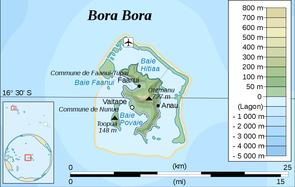
Deutsch: Topographische Karte von Bora Bora, Gesellschaftsinseln, Französisch-Polynesien
English: Topographic map of Bora Bora, Society Islands, French Polynesia |
| Datum | |
| Bron | Eigen werk, based on original from Sardon |
| Auteur | modified by Telim tor |
| Andere versies |

Licentie
| Ik, de auteursrechthebbende van dit werk, geef dit werk vrij in het publieke domein. Dit is wereldwijd van toepassing. In sommige landen is dit wettelijk niet mogelijk; in die gevallen geldt: Ik sta iedereen toe dit werk voor eender welk doel te gebruiken, zonder enige voorwaarden, tenzij zulke voorwaarden door de wet worden voorgeschreven. |
Bestandsgeschiedenis
Klik op een datum/tijd om het bestand te zien zoals het destijds was.
| Datum/tijd | Miniatuur | Afmetingen | Gebruiker | Opmerking | |
|---|---|---|---|---|---|
| huidige versie | 14 sep 2010 12:34 | | 998 × 634 (149 kB) | Telim tor | == {{int:filedesc}} == {{Information |Description= {{de|Topographische Karte von Bora Bora, Gesellschaftsinseln, Französisch-Polynesien}} {{en|Topographic map of Bora Bora, Society Islands, French Polynesia}} |Source={{own}}, based on original from [[fr: |
Bestandsgebruik
Dit bestand wordt op de volgende pagina gebruikt: