Bestand:Guyana-CIA WFB Map.png
Naar navigatie springen
Naar zoeken springen
Geen hogere resolutie beschikbaar.
Guyana-CIA_WFB_Map.png (329 × 353 pixels, bestandsgrootte: 17 kB, MIME-type: image/png)
Beschrijving
| Beschrijving |
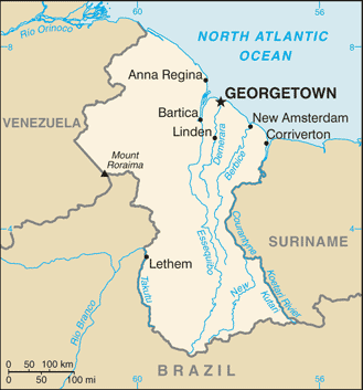
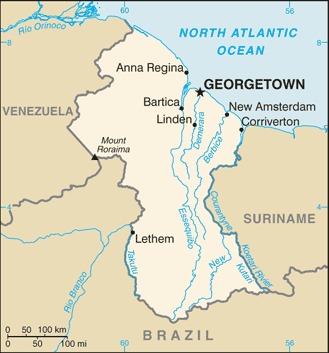
English: Map of Guyana.
Français : Carte du Guyana.
Italiano: Mappa della Guyana. |
|||
| Datum | ||||
| Bron | https://www.cia.gov/the-world-factbook/static/maps/GY-map.jpg | |||
| Auteur | Directorate of Intelligence, CIA | |||
| Toestemming (Hergebruik van dit bestand) |
|
|||
| Andere versies |
|


Bestandsgeschiedenis
Klik op een datum/tijd om het bestand te zien zoals het destijds was.
| Datum/tijd | Miniatuur | Afmetingen | Gebruiker | Opmerking | |
|---|---|---|---|---|---|
| huidige versie | 21 jul 2007 10:02 | | 329 × 353 (17 kB) | Hoshie | Updated map of Guyana from the CIA World Factbook, 14 June 07 rev. Src: https://www.cia.gov/library/publications/the-world-factbook/maps/gy-map.gif |
Bestandsgebruik
Geen enkele pagina gebruikt dit bestand.