Bestand:Iberian Peninsula antique map.jpg
Naar navigatie springen
Naar zoeken springen

Grootte van deze voorvertoning: 739 × 599 pixels. Andere resoluties: 296 × 240 pixels | 592 × 480 pixels | 740 × 600 pixels | 947 × 768 pixels | 1.263 × 1.024 pixels | 2.096 × 1.700 pixels.
Afbeelding in hogere resolutie (2.096 × 1.700 pixels, bestandsgrootte: 5,81 MB, MIME-type: image/jpeg)
|
Beschrijving
| Beschrijving |
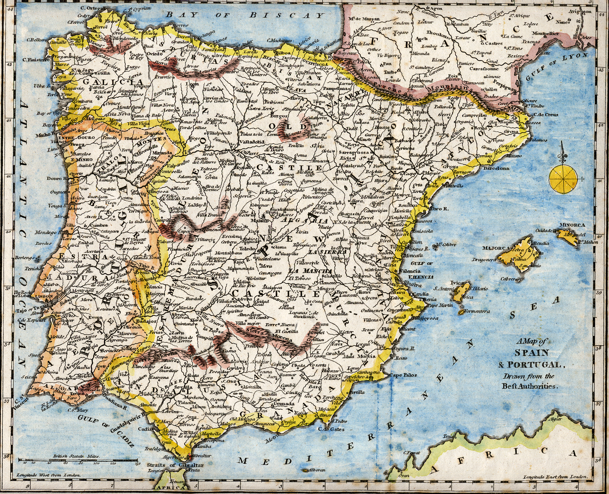
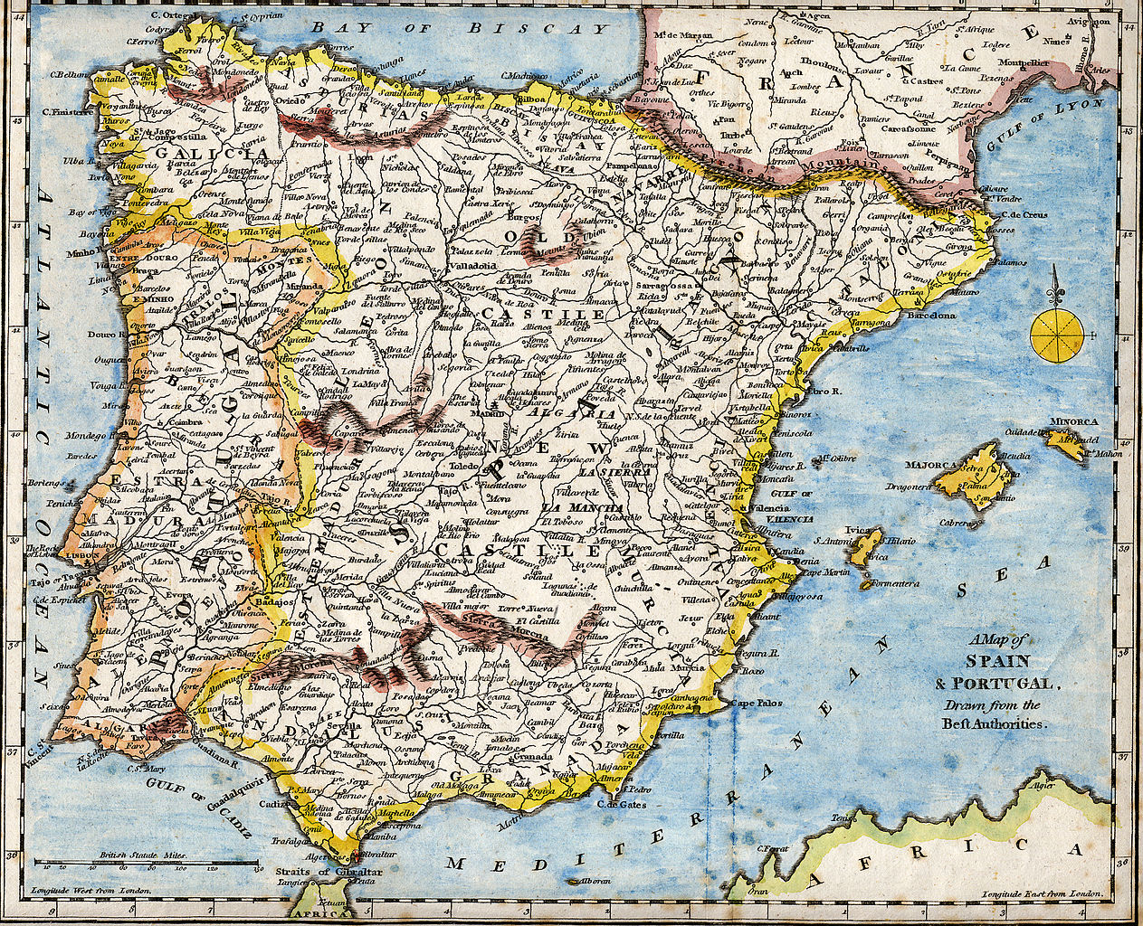
English: 18th century hand-coloured engraved map of the Iberian peninsula depicting various topographical features of the land, as published in Robert Wilkinson's General Atlas, circa 1794. (Volume 2., page 666.)
Titl'd A Map of Spain & Portugal, Drawn from the Beſt Authorities Español: Mapa del siglo XVIII grabado al cobre e iluminado a mano, representando varias características topográficas de la Península Ibérica. Publicado en el atlas general de Robert Wilkinson (volumen 2., página 666.)
Português: Mapa do século XVIII gravado em cobre e iluminado a mão, representando várias características topográficas da Península Ibérica. Publicado no atlas geral de Robert Wilkinson (volume 2., página 666.)
Català: Mapa del segle XVIII grabat al coure i il·luminat a mà, representant diverses característiques topogràfiques de la Península Ibèrica. Publicat en l'atles general de Robert Walkinson (volum 2., pàgina 666) |
||||||||||||||||||||||
| Datum | circa 1794 | ||||||||||||||||||||||
| Bron | Scanned from my personal collection. (scanned by User:RedCoat) | ||||||||||||||||||||||
| Auteur |
|
||||||||||||||||||||||
| Locatie | [published at] No. 58 Cornhill London, England | ||||||||||||||||||||||
Licentie
|
Dit werk bevindt zich in het publiek domein in landen en gebieden waar de auteursrechttermijn het leven van de auteur plus 70 jaar of minder is. | |
| Van dit bestand is vastgesteld dat er geen bekende auteursrechtaanspraken op rusten, alle aanverwante en naburige rechten daarbij inbegrepen. | |
Bestandsgeschiedenis
Klik op een datum/tijd om het bestand te zien zoals het destijds was.
| Datum/tijd | Miniatuur | Afmetingen | Gebruiker | Opmerking | |
|---|---|---|---|---|---|
| huidige versie | 28 okt 2007 19:01 | | 2.096 × 1.700 (5,81 MB) | RedCoat | {{Information | Description ={{en|18th century hand-coloured engraved map of the Iberian peninsula depicting various topographical features of the land, as published in Robert Wilkinson's ''General Atlas'', circa 1794. |
Bestandsgebruik
Dit bestand wordt op de volgende pagina gebruikt: