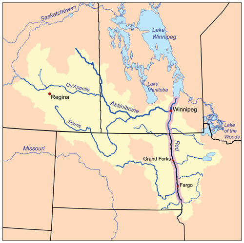
Bestand:Redrivernorthmap.png
Naar navigatie springen
Naar zoeken springen
Redrivernorthmap.png (500 × 499 pixels, bestandsgrootte: 137 kB, MIME-type: image/png)
Bestandsgeschiedenis
Klik op een datum/tijd om het bestand te zien zoals het destijds was.
| Datum/tijd | Miniatuur | Afmetingen | Gebruiker | Opmerking | |
|---|---|---|---|---|---|
| huidige versie | 15 feb 2007 18:16 |  | 500 × 499 (137 kB) | Kmusser | This is a map of the Red River of the North drainage basin, with the Red River highlighted. I, Karl Musser, created it based on USGS and [[:en:Digital Chart of the World|Digital Chart of the |
Bestandsgebruik
Dit bestand wordt op de volgende pagina gebruikt:
