Bestand:Tubenose goby map.png
Naar navigatie springen
Naar zoeken springen


Grootte van deze voorvertoning: 675 × 599 pixels. Andere resoluties: 270 × 240 pixels | 541 × 480 pixels | 676 × 600 pixels | 865 × 768 pixels | 1.248 × 1.108 pixels.
Afbeelding in hogere resolutie (1.248 × 1.108 pixels, bestandsgrootte: 1,19 MB, MIME-type: image/png)
Beschrijving
| Beschrijving |
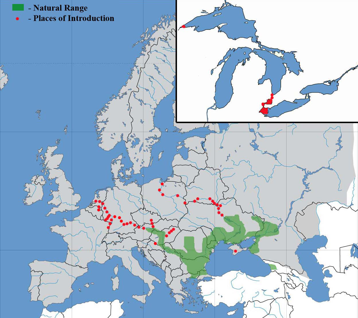
English: Tha range of the western tubenose goby (Proterorhinus semilunaris) in Old World and North-American Great Lakes
Українська: Ареал бичка-цуцика західного (Proterorhinus semilunaris) у Старому Світі та Північноамериканських Великих Озерах |
|
| Datum | ||
| Bron | Eigen werk | |
| Auteur |
|
Licentie
Ik, de auteursrechthebbende van dit werk, maak het hierbij onder de volgende licentie beschikbaar:
Dit bestand is gelicenseerd onder de Creative Commons Naamsvermelding-GelijkDelen 4.0 Internationaal licentie.
- De gebruiker mag:
- Delen – het werk kopiëren, verspreiden en doorgeven
- Remixen – afgeleide werken maken
- Onder de volgende voorwaarden:
- naamsvermelding – U moet op een gepaste manier aan naamsvermelding doen, een link naar de licentie geven, en aangeven of er wijzigingen in het werk zijn aangebracht. U mag dit op elke redelijke manier doen, maar niet zodanig dat de indruk wordt gewekt dat de licentiegever instemt met uw werk of uw gebruik van zijn werk.
- Gelijk delen – Als u het materiaal remixt, transformeert of erop voortbouwt, moet u uw bijdragen verspreiden onder dezelfde licentie als die van het origineel, of een licentie die daarmee verenigbaar is.
Bestandsgeschiedenis
Klik op een datum/tijd om het bestand te zien zoals het destijds was.
| Datum/tijd | Miniatuur | Afmetingen | Gebruiker | Opmerking | |
|---|---|---|---|---|---|
| huidige versie | 6 mrt 2024 23:58 | | 1.248 × 1.108 (1,19 MB) | Iktsokh | More correct visualization of the dividing line on the territory of the Caucasus Range |
Bestandsgebruik
Dit bestand wordt op de volgende pagina gebruikt: