Nationaal Landschap Het Groene Woud: verschil tussen versies
Naar navigatie springen
Naar zoeken springen
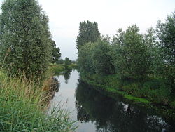
(Nieuwe pagina aangemaakt met '{{Infobox Nationaal Landschap | naam = Nationaal Landschap Het Groene Woud | afbeelding = Dommeldal_SintOedenrode.jpg | onderschrift = Dommeldal bij Si...') |
k (Categorie:Nationaal landschap toegevoegd met HotCat) |
||
| Regel 14: | Regel 14: | ||
| website = [https://www.hetgroenewoud.com/ Nationaal Landschap Het Groene Woud] | | website = [https://www.hetgroenewoud.com/ Nationaal Landschap Het Groene Woud] | ||
}} | }} | ||
| + | |||
| + | [[Categorie:Nationaal landschap]] | ||
Versie van 10 jun 2024 12:29
| Nationaal Landschap Het Groene Woud | |
| Land | |
| Classificatie | bossen, moerassen, heide en agrarisch populierenlandschap |
| Km2 | 350 km² |
| Locatie | |
| Dichtbij | Best, Boxtel, Meierijstad, Oirschot, Oisterwijk (met Haaren), Sint-Michielsgestel, Son en Breugel |
| Gesticht | 2005 aangewezen als Nationaal Landschap |
| Website | Nationaal Landschap Het Groene Woud |

| |
| Dommeldal bij Sint Oedenrode | |

| |
| Ligging van Het Groene Woud | |
| Portaal | |